
Highlights
- Positive results from recent airborne Magnetic & Radiometric Survey
- 12miles (19km) of anomalous uranium trends interpreted from airborne survey
- 6 prominent uranium anomalies were identified across the Project
- Anomalies correlate with historically identified drill holes, interpreted trends,
areas of past mining and/or known mineralisation - 28 additional claims staked, based on results of the geophysical surveys,
bringing the total holdings to 697 mining claims comprising circa 14,000 acres - Next steps: Planning & permitting for follow up drilling
“The aerial geophysical survey has provided
us with clear direction as to where to drill at Green Mountain. We have been able to utilise the
historical drilling and geological information completed by Kerr McGee Corporation, Wold
Nuclear and others during the 1970’s and 1980’s to help interpret and extrapolate significant
additional anomalous uranium trends, particularly within the eastern part of the extensive Green
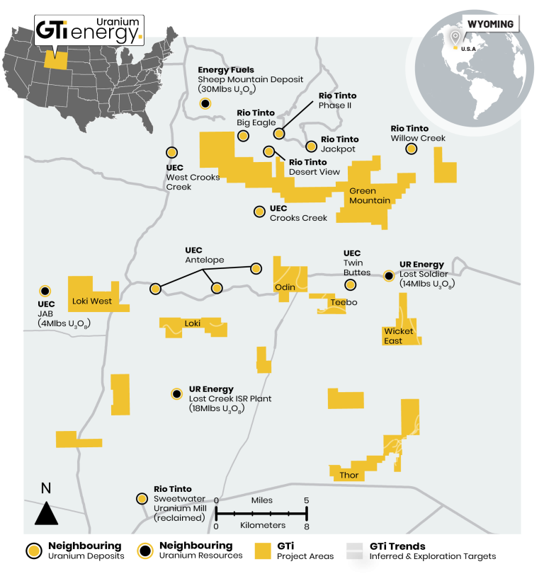
Mountain land position. The land package is surrounded by significant uranium deposits and
resources owned by Rio Tinto, Energy Fuels, Ur Energy & UEC, so we know we are in an area
with real potential. Our next step is to progress work on refining drill targets and permitting”.
Bruce Lane
Executive Director
